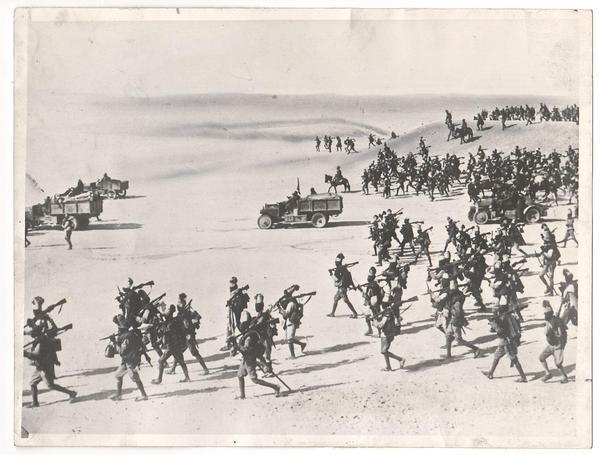
I stumbled across this rather nice treatment of The Abyssinian War for the rule system, Flames of War – a very popular WW2 game system as most people will know.
I don’t know who did it or from what site as the direct link I found didn’t come from a webpage so I can’t give credit to the author, who did a rather good job of it all. Whilst there are a few things that might need adjusting overall it’s a pretty good take on the period for that game system. What it really shows is just how the Abyssinian War can be gamed at what ever scale you prefer, from large multi battalion level battles down to platoon level skirmishes. Flames of War pitches nicely in the company level game providing both low level detail but a big enough scale to bring in many aspects of each combatant’s support arms.
As lots of people have WW2 Italians in sun helmets and perhaps some colonial war period white clad African types then a game using this rule set would be achievable using existing resources or minimal investment. The Imperial Guard would be any WW1 British infantry as well. Drop in some vehicles and guns and you are away! There are many actions that can be portrayed at the company level game scale of Flames of War so this does have some appeal all of its own.
One aspect of this rules supplement that is pretty handy for the Abyssinian gamer is the nice terrain set up system. This is rather good as it divides the terrain types into those of the Northern and Southern theatres of operation so allowing for plausible and agreeable table layouts. The descriptions are generic enough that they can be applied to any game system and thus are pretty handy no matter what scale of game you are playing. I’ve included the text of the terrain layout system below for ease of reference and the complete FOW Abyssinian War supplement can be downloaded here.
..
.
.
Abyssinian War terrain Set-Up Method
Ethiopian Terrain Guide
The Second Italo Ethiopian War was fought on a wide variety of terrain, from the jagged mountains of the north to the deserts of the Ogaden, bordering Somalia. The countryside is sparsely populated with villages and farms. Rough trails serve as the only roads across this landscape.
This chart provides an optional way to decide what terrain to place on the table.
Before starting a battle, decide if it is being fought on the Northern or Southern front, as this will determine whether you are fighting in harsh mountains or scrub covered desert. Divide the table into 2’ squares, with each player taking a turn to pick a square and roll to see what terrain is in it. This table is intended to be merely a suggestion, and the final layout of the table is up to the players.
.
Northern Front-Ethiopian Highlands
The predominant terrain feature here is wooded hills and ridges, with clusters of farms and villages connected by narrow dirt roads.
1 or 2: Ridges and Hills
roll again:
1 Valley: this area is relatively open, with grassland and a few trees covering the area between two low rises (at least 12” long). The rises are cross-country terrain. It should be tall enough to conceal units on the far side. Try to connect valleys in adjacent squares.
2 or 3 Ridge: A steep rocky outcrop (at least 12” long) provides a good amount of elevation in the area. The ridge is Difficult Going and is much taller than a tank or truck. Try to connect ridges in adjacent squares.
4 or 5 Hills: The area is covered by one to three foothills, descending from the nearby mountains. A hill is Cross-country terrain. It should be tall enough to conceal units on the far side.
6 Rocks: The area is strewn with large boulders, making it a great place for infantry to hide but difficult for vehicles to navigate. One or two areas of rocky ground (at least 12” across) swell from the surrounding grassland. The terrain is Very Difficult Going and provides Bulletproof Cover to Infantry and Gun Teams.
3: Woods
roll again:
1 to 3 Large Wood: A large wood covers most of this area. Try to connect large woods in adjacent squares.
4 to 6 Scattered Woods: One or two small woods (at least 12” across) cover the area.
4 or 5: Villages
roll again:
1 Village: A village of four to twelve houses along a single dirt road. A village must have a dirt road leading to another road or village, or to a table edge.
2 or 3 Hamlet: A hamlet of three to six houses along a single dirt road. A hamlet must have a dirt road leading to another road or village, or to a table edge.
4 to 6 Homestead: One or two houses and a number of crop fields, next to a single dirt road. A homestead must have a dirt road leading to another road or village, or to a table edge.
6: Water Features:
roll again:
1 River: The mighty Tekeze River cuts its way through your battlefield. A treelined river flows across the table. It flows between two table edges through all river squares. The river is Impassable and must have a road bridge or ford (Difficult Going) in each square it passes through.
2 to 4 Stream: A treelined stream runs through the battlefield. The stream must connect to streams in adjacent squares and must meet the table edge or a river at one or both ends. The stream is Very Difficult Going and must have a road bridge or ford (Difficult Going) in each square it passes through.
5 or 6 Marsh or Lake: An area of wetland or a lake (at least 12” across) or three smaller areas (up to 6” across).
.
Southern Front – Ogaden Desert
The predominant terrain feature here is shrubland, with rocky outcrops and low, sandy hills.
1 or 2: Desert Features
roll again:
1 or 2 Savannah: The area is flat and covered in dry grass.
3 or 4 Sandy Hill: A hill in this area is covered in soft sand, but careful driving should get vehicles over it safely. A sandy hill (at least 12” across) is Difficult Going, and troops cannot Dig In here. The hill should be tall enough to hide units on the opposite side.
5 or 6 Rocks: The area is strewn with large boulders, making it a great place for infantry to hide but difficult for vehicles to navigate. One or two areas of rocky ground (up to 12” across) swell from the surrounding grassland. The terrain is Very Difficult Going and provides Bulletproof Cover to Infantry and Gun Teams.
3 to 5: Vegetation
roll again:
1 to 3 Scattered Scrub: The area has just enough water to sustain a few shrubs and tufts of grass. Areas of scattered scrub do not hinder movement, but provide Concealment for Infantry and Manpacked Gun teams.
4 or 5 Shrubland: The area is covered in dense brush and tall grass, providing little cover but hindering movement. Areas of shrubland (at least 12” across) are Difficult Going, and provide Concealment for Infantry, Manpacked Gun teams, and stationary Light and Medium Gun teams.
6 Baobab Grove: A handful of enormous Baobab trees tower over the surrounding grassland. A small wood (at least 12” across) is in this area. Try to place this adjacent to areas of Shrubland.
6: Villages
roll again:
1 Village: A village of four to twelve houses along a single dirt road. A village must have a dirt road leading to another road or village, or to a table edge.
2 Hamlet: A hamlet of three to six houses along a single dirt road. A hamlet must have a dirt road leading to another road or village, or to a table edge.
3 to 6 Homestead: One or two houses, with a large fenced area nearby for holding livestock. A homestead in the Ogaden does not require any road connection.


